
Overview:
Palau is in for another hot and humid week, with scattered showers, rising surf and stronger rip current risks expected through the weekend. Forecasters say the biggest concern will be rougher seas along east-facing reefs and beaches.
Forecasters warn of stronger surf, isolated thunderstorms and heat index near 100 degrees
By: L.N. Reklai
AIRAI, Palau (May 7, 2026)— Residents can expect another week of warm, humid weather across Palau, with scattered showers, rougher surf and dangerous rip currents developing along some coastlines as weather systems move through the western North Pacific.
Weather officials say no direct tropical cyclone threat is expected for Palau at this time, but nearby disturbances north of Yap and near Guam are helping create unsettled conditions that will continue into early next week.
Throughout the week, skies are expected to shift between partly cloudy and mostly cloudy, with the cloudiest periods forecast for Thursday night and again Sunday into Monday. Passing showers are expected on and off, with rain coverage ranging between 30 to 50 percent over the islands and nearby waters.
Most showers are expected to be brief, but drivers should still prepare for wet roads and temporary ponding in low-lying areas. Visibility could also drop during heavier showers. Thunderstorm chances remain low at around 10 percent, though isolated storms could still bring lightning, gusty winds and short bursts of heavy rain.
Temperatures will remain typical for May, with daytime highs reaching the mid- to upper-80s and nighttime lows settling in the upper-70s. However, humidity levels will make conditions feel much hotter, with heat index “feels like temperatures” values climbing into the upper-90s and even low-100s through Friday.
Officials are encouraging residents to stay hydrated, avoid prolonged outdoor activity during the hottest afternoon hours and check on elderly family members, children and workers exposed to the heat.
At sea, winds are expected to remain generally light at around 10 knots or less, shifting direction several times over the coming days. Wind waves are forecast to stay small at about 2 feet or less.
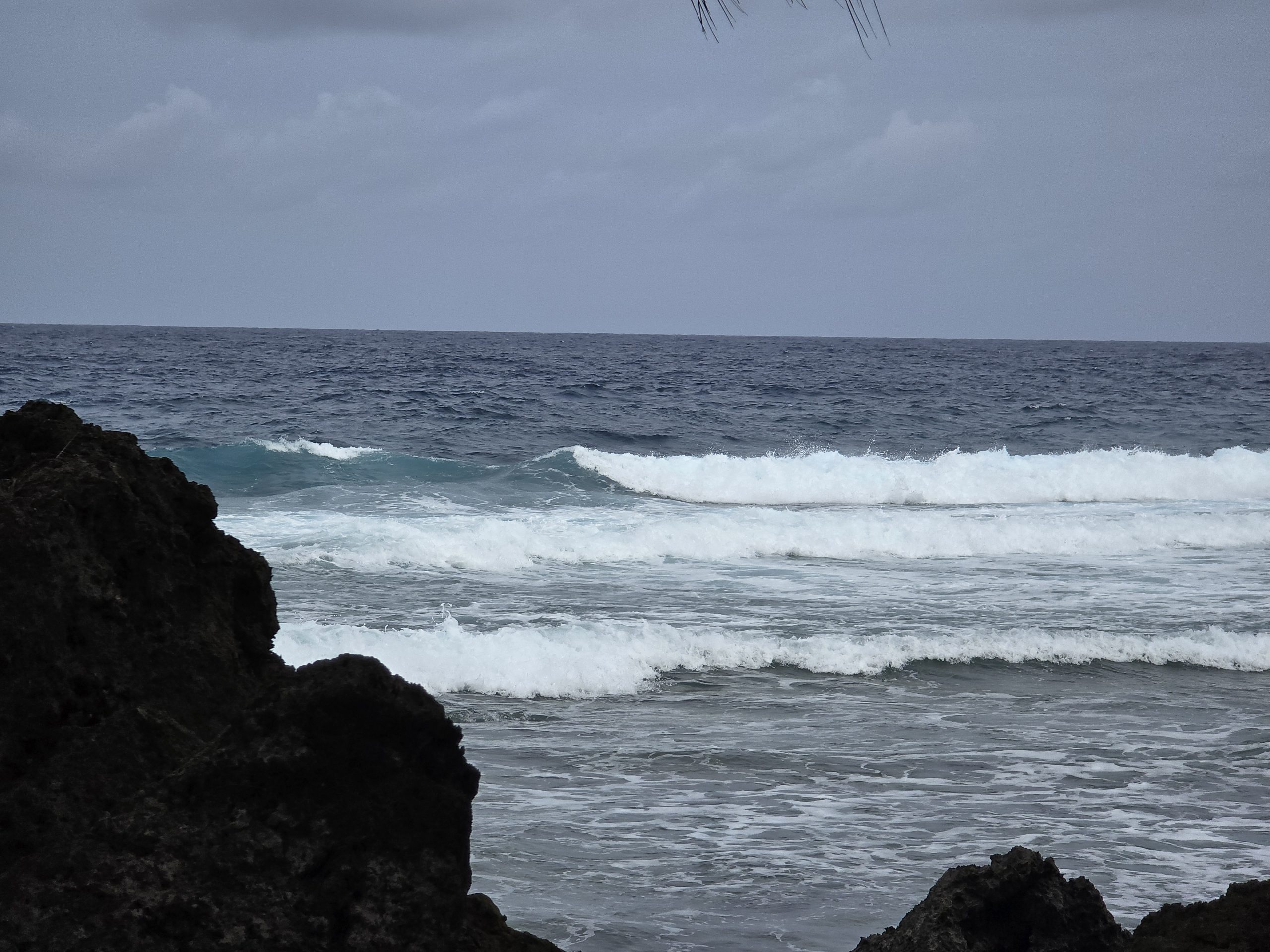
The bigger concern will be increasing northeast swells building across Palau waters.
Forecasters say swell heights of 3 to 4 feet will continue through Thursday before increasing to 4 to 5 feet Thursday night. By Friday through Sunday, northeast swells are expected to peak near 6 feet, creating surf of up to 9 to 10 feet in some exposed areas.
Those conditions could generate dangerous rip currents, especially along east-facing reefs and beaches. Swimmers, surfers and small boat operators are being urged to use extra caution and closely follow advisories from local authorities and lifeguards.
Despite the unsettled pattern, weather officials say current forecasts show the nearby tropical systems continuing to move away from Palau, reducing the likelihood of damaging winds or severe weather impacts.
Residents and visitors are advised to continue monitoring official weather updates and marine advisories through the National Weather Service and the National Emergency Management Office.